Phil Koch's Notes
Notes submitted or commented on by Phil Koch
| Id | Creator | Description | Created at | Last changed | |
|---|---|---|---|---|---|
| 4885440 | Phil Koch | The lake and all the lakes in this town currently denoted as "Princes" should be changed to "Prince's". The town's name is Prince's Lakes and all of the lakes contain the possessive of Prince: Prince's.
|
|||
| 4885444 | Phil Koch | The lake and all the lakes in this town currently denoted as "Princes" should be changed to "Prince's". The town's name is Prince's Lakes and all of the lakes contain the possessive of Prince: Prince's.
|
|||
| 4885507 | Phil Koch | This section of the road is not Bear Wallow Hill Road, it is Greasy Creek Road.
|
|||
| 4885510 | Phil Koch | Not only is this road not a public road, it's not a road and it's not called Bear Wallow Hill Road. This is a private driveway.
|
|||
| 4885499 | Phil Koch | Not sure why this road has so many names. The one correct name for this road is: Hornettown Rd. You can reference that here: https://brownin.wthgis.com/ |
|||
| 4885501 | Phil Koch | Not sure why this road has so many names. The one correct name for this road is: Hornettown Rd. You can reference that here: https://brownin.wthgis.com/ |
|||
| 4492806 | Phil Koch | This road is not East St. Rd 252. That is miles further south. This stretch (between Conservation Club Road and South Hickey Road) is named Hickey Road as per the google street view: https://www.google.com/maps/@39.4108353,-86.3040071,3a,75y,49.55h,65.45t/data=!3m7!1e1!3m5!1sg9wDYHRv4twFD4W4cUJDCA!2e0!6shttps:%2F%2Fstreetviewpixels-pa.googleapis.com%2Fv1%2Fthumbnail%3Fcb_client%3Dmaps_sv.tactile%26w%3D900%26h%3D600%26pitch%3D24.552650401471666%26panoid%3Dg9wDYHRv4twFD4W4cUJDCA%26yaw%3D49.55362795392714!7i16384!8i8192?coh=205410&entry=ttu&g_ep=EgoyMDI0MTAyMS4xIKXMDSoASAFQAw%3D%3D |
|||
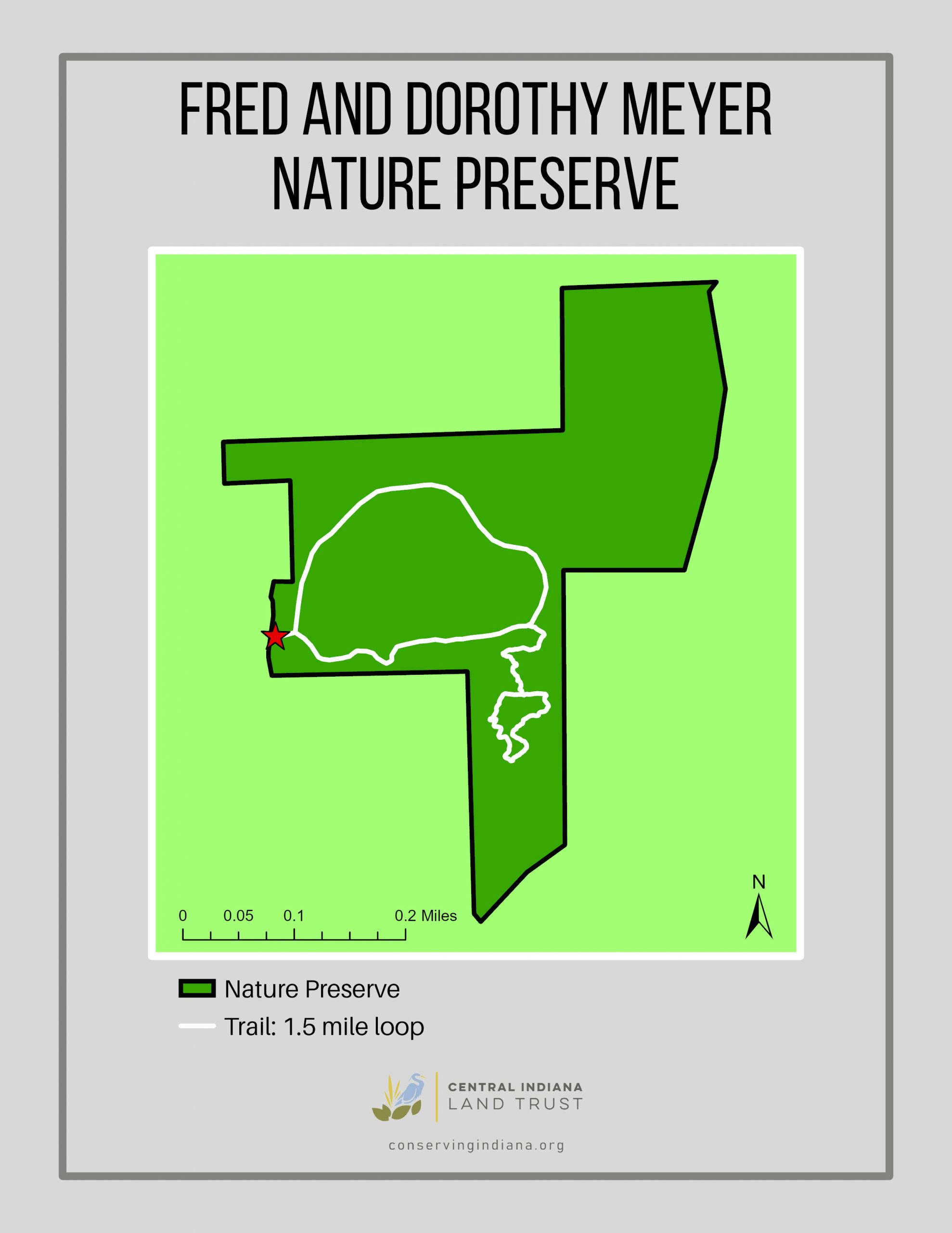
| 4582118 | Phil Koch | There is now an additional small loop to the south. Map here: https://conservingindiana.org/wp-content/uploads/2022/07/Meyer2022Trail1-scaled.jpg |
|||
| 4443613 | Phil Koch | Lick Creek Road is currently labeled as unpaved from north of the intersection of Hassetown Rd and just north of the county line. This road is paved. Last traveled on the road in September, 2024. |
|||
| 4443609 | Phil Koch | This road is incorrectly tagged as unpaved. The road is paved. I last travelled on this in September, 2024. |