Kovoschiz's Comments
| Changeset | When | Comment |
|---|---|---|
| 153055984 | over 1 year ago | Please don't directly delete them, as they represent a shop space, and may have addresses or other info. It causes more work to add back new tenants later, and waste previous user's effort. Please change it to a plain "point" to eliminate it. |
| 152982722 | over 1 year ago | Please don't remove `building=` from actual buildings. `=substation` should only be separated when there is an entire fenced site for it. |
| 152991260 | over 1 year ago | 1. You should change it to `sidewalk:both=separate` , not remove the `sidewalk=` only. Furthermore, the network of `=footway` should be ensured to be correctly drawn and fully connected.
|
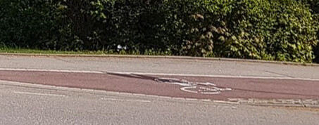
| 152935662 | over 1 year ago | Please don't change `=mini_roundabout` points to a `junction=roundabout` line. They exist in this form for a reason. The center is traversable. Larger vehicles can travel through it as a standard intersection. |
| 152781740 | over 1 year ago | Please don't change `=footway` to `=path` . `=footway` has a specific meaning. `=path` alone is generic and unclear. |
| 152505764 | over 1 year ago | Please don't directly delete them, as they can have addresses or floor info, and still represent a store space. It makes tracking and updating new tenant later difficult. Simply changing them to a plain "Point" to eliminate them. |
| 152425486 | over 1 year ago | We can sort out our differences and clarify the opposing views first, before presenting to the global audience to decide osm.wiki/User_talk:Kovposch#Double_"parking" |
| 152425486 | over 1 year ago | If you mean the regional post, sorry I don't read German, so I didn't notice it https://community.openstreetmap.org/t/parken-in-gekennzeichneten-flachen-erlaubt/113946/
|
| 152425486 | over 1 year ago | So it's not based on a legal default that shouldn't be added. We clearly distinguish whether stopping is allowed outside parking bays here. |
| 152425486 | over 1 year ago | We have double "parking"/stopping restrictions here. The double solid yellow is marked between the parking bay and the travel lane.
|
| 152322590 | over 1 year ago | 1. Please don't add bracketed descriptor labels to `name=` , which is for proper names only. Don't make them up artificially. Use `description:zh=` for such text.
|
| 152250605 | over 1 year ago | Please discuss this controversy before you change `old_name=` to `name=` |
| 152072953 | over 1 year ago | I believe `traffic_sign=none` was discussed to mean no plates, but there can be markings https://community-cdn.openstreetmap.org/uploads/default/original/2X/c/cec22899d55dead5714839e00eb430e9f6f92037.jpeg https://community.openstreetmap.org/t/fahrradinfrastruktur-tagging-realitat-und-fragen/8417 |
| 152072953 | over 1 year ago | And where is this documented or discussed?
|
| 152072953 | over 1 year ago | The application and rendering of signs is completely different from markings. Mixing them in `traffic_sign=` directly causes a mess (including to applications using them now), and requires more processing to identify whether they are panels or markings. |
| 152072953 | over 1 year ago | Should the use of `traffic_sign=` be redefined to include markings? I have only seen you suggest this now. Diluting it still pollutes the data. |
| 152072953 | over 1 year ago | Fundamentally, in this direction of thinking, `road_marking=` could still be treated as a combination under some hypothetical `traffic_sign:*=road_marking` ...
|
| 152072953 | over 1 year ago | 1. The common language connotation is preferable over some legal interpretation. Despite being titled "Traffic Sign" , Vienna Convention is still split into chapters of "Traffic Sign" and "Road Marking". Under TSRGD, UK's Traffic Signs Manual still mentions "on the correct use of traffic
|
| 152098034 | over 1 year ago | Please notice that tower-on-podium architecture is standard in HK. `building=` is used by convention. They are considered different buildings. `building=` + building:min_level=* is allowed.
|
| 152072953 | over 1 year ago | I'm transitioning from `road_marking=` to `road_marking:id=` as words are predominant in `road_marking=` |