Harry Wood's Comments
| Post | When | Comment |
|---|---|---|
| Marikina Mapping Party @ Lilac Street | That’s perfect GOwin. Thanks! This will most probably be featured image next week |
|
| Marikina Mapping Party @ Lilac Street | Great photos! D’you reckon we could make a little montage of these to have as “image of the week”? Can I have permission to put them on the wiki with a CC BY-SA 2.0 license? |
|
| Fixing multipolygons for the renderer | Oh yeah. I came across one of those while fixing. I guess this is a peculiarity of landuse (/landcover/natural) tags actually. I mean as soon as you add a name tag, or any “top level” object tagging (e.g. amenity=school / shop=supermarket) then it becomes correct to use a multipolygon per “One feature, one OSM element”, but if it’s solely tagged landuse (and maybe some other properties tags) then it’s nicer to stick with ways. |
|
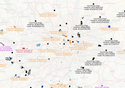
| Fixing multipolygons for the renderer | Last night I did a bunch of fixing, and as I look back at OSM inspector today, I can see that I succeeded in my aim, to fix all the pink errors in London (within the M25). This is satisfying.
…but among this sampling of multipolygon relations I think I noticed an another automated check we might do. I noticed some multipolygons which were created as two or more ways as ‘outer’ role, together forming a simple area, which was unnecessary and could be represented as a normal way. We should “simplify down” to a way in these cases. The criteria for this kind of “unnecessary” is possibly a bit complicated, but can be deteremined automatically. We’d need check none of the parts have other tags/memberships (or if they do have tags, they would need to all be the same tags). Also tricky things like tagging involving oneway directional ways might be a legitimate reason for splitting the area up into a multipolygon. Also if an multipolygon area has very many nodes (e.g. big lakes) then that’s a legitimate reason. But otherwise… it can be just a way, and it should just be a way. I wonder how many of these unnecessary multipolygons there would be. Maybe the map is totally littered with them. |
|
| Fixing multipolygons for the renderer | hmm yeah. Coastlines. That old problem. They’re big and they break all the time. I suppose I’m after a measure the “most significant” disappearing objects. Could be a fuzzy measure of various factors, but… easier judged manually I suppose |
|
| Nostalgic Mapping | I like this about mapping. It makes me look at my own neighbourhood in a new way, and notice things I wouldn’t otherwise notice. And when I go back to where I grew up, and I can compare things with how I remember them (although I have be careful not to depend on my foggy memories from childhood when I’m putting the data in) |
|
| Copying from Google Maps | I feel like the “Don’t copy from google maps” thing is something we’ve repeated on various contact channels endlessly. These days id is prompting people to set a ‘source’ a bit more, and we can use changeset comments, but we should link people to official looking advice. Where’s the best advice place to link to? Maybe this FAQ entry. |
|
| Notes are brilliant | I agree. Notes are brilliant. I gave them special mention in my recent talk on ways of contributing to OpenStreetMap, trying to leave it towards the end so that people remember it even if some of the other suggestions look scary and complicated. I feel like there’s even greater potential than we are currently realising. There’s things we could do to make adding notes using the website better (and make the notes that are added better), although we should be careful to resist making it more complicated. It could be integrated into “report a problem” links on other map sites better. And lots of tools we could build (or perhaps roll improvements into the main site) for mappers to browse all the notes. Lots of untapped potential there. |
|
| Building an inclusive map - OSM and gender discussion | Oh geez. I just followed that link to Severin’s diary entry. What a load of hogwash. He’s still working so hard to damage HOT after all this time. And I guess we can take Alex’s comment as indication that people read this stuff and believe it. Part of me is tempted to go to work on setting the record straight, but a bigger part of me has no energy left for fighting that fight. |
|
| Building an inclusive map - OSM and gender discussion | Shutting down the osmf-talk@ mailing list? hmmm. interesting idea. “When people accuse the lists of being ‘toxic’, this is invariably the one they mean.” That’s true recently, but angry flamewars have erupted on other discussion channels in the past. The talk@ list hasn’t always been a pussy cat. Isn’t it the case that angry discussions will occasionally happen wherever discussions happen? Perhaps more so for election related discussions. It could be a good symbolic move, to show that the issue of toxic mailing lists is being taken seriously. I agree about the force-subscribing being an issue. I think that decision was taken too rapidly by somebody a few years ago. Fresh-faced foundation members should not find themselves bombarded by angry discussion emails. Seems to me it was always a bad idea. That’s a change we can make. Perhaps we could also go back to people who were force-subscribed recently and say “We’re not doing this for new members any more, and we’ll understand if you want to drop off this discussion list too. It’s not a requirement”. Or of course if we were shutting down osmf-talk, then we wouldn’t need to do that. One thing left behind by that, is the loss of any “push mechanism” (email) for important news about the foundation. The osmf-announce read-only email list is a thing, but it hasn’t been used since 2014. Perhaps for good reason. Solving this is more CWG’s realm. We’re less actively involved in solving mailing list moderation issues, and while I think we could regard CWG as a final arbiter on mailing list issues, I would happily punt that job off to a new “Discussions working group” or something. But what we are involved in is trying put out news and announcements on foundation matters. We currently do this via the blog and social media. That’s not pushing emails though. Perhaps if we could send blog content to osmf-members by email somehow, that would fill that gap. Note: I’m mostly thinking about what the default new member experience should be. Obviously any email mechanism would allow opt-out. |
|
| Proposed Admin Levels for Turkmenistan | I have general comments on the use of admin_level=11. This is not a desirable tag to be using because the initial conception of this tag was that it takes a value from 1 to 10. Simple. Local countries then devise a mapping across from their administrative levels onto these numerical values. If you are finding your country needs to map across onto value 11, then it means something went wrong with that, and the mapping was devised badly in the first place. To put it another way. Don’t look at this list of countries and say “hey I think we should join the club of countries with extra-fine-grained admin levels”. Instead you should think “Hopefully we can avoid joining this list of countries who have foolishly failed to map their admin level values correctly”. |
|
| Zoffany Street | heh. I wondered what the first hyper detailed mapping comment would be. The diagonal fence does look a bit like a mapping mistake hey? but no. It’s diagonal. Although it might not be very accurately done. Can’t see it all in bing. It’s all new. And quite a tall fence. I’ll have to fly drone there some time. |
|
| OpenStreetMap 13th Anniversary Birthday party in Minsk, Belarus | We’re looking for featured image proposals at the moment. In fact we’re overdue one for this week. I like the group photo including the cake. We just need an image uploading there with an open license. |
|
| Adding vector tiles to the components diagram | yes. Well OpenCycleMap is missing I noticed after writing this. In the interests of compactness we could probably just change “Transport Renderer” to “OpenCycleMap & Transport Map”. The other thing I added was connections to the “Front page map” from these things. This is the justification for including these specific renderers on the diagram at all. They’re the featured tile layers. The little database symbol below Transport Renderer, I suppose I’m thinking this vaguely represents a datastore of some kind, but this is the ThunderForest rendering stack. It could be expanded out. All gets a lot less compact then though. Then we’re going towards the other diagram I want, which would show different types of vector tiles. |
|
| lazy Saturday morning | Good stuff. Lots of green notes there! osm.org/#map=13/37.9292/58.3929&layers=N I’m working on widening my “note free radius” in London :-) |
|
| Meo choi bong da | SPAM |
|
| Long Names of OpenStreetMap | I put reply to this on the wiki here: osm.wiki/Talk:Names#Very_long_names._bad_practice.2Fbug.3F mainly because my osm account was weirdly broken for a while, and I couldn’t reply here … but also it’s good to discuss ‘name’ issues there |
|
| Retaining New Users | heh. Sorry yes. I suppose i might have been referring to your suggestions in the blog post, but no! I like your suggestions! There’s just one spam comment above here (which will hopefully not remain here for too much longer) |
|
| Retaining New Users | SPAM |
|
| Heavy Usage on OSM Sites | It might be a “quick” way to the info, but a “better” way to get the info would be the talk mailing list, the osmf-talk mailing list IRC, the OWG contact email, github issue, or …actually pretty much any of the contact channels would have been more appropriate than a diary entry. |