OpenStreetMap logo OpenStreetMap

Harry Wood's Diary

Recent diary entries

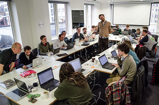
We’ve had a few OpenStreetMap events lately which I didn’t report back on yet. The big one of course. State of the map, up in Birmingham. I’ll come back to that, but also quite a few London events (The next London event is this coming Thursday)

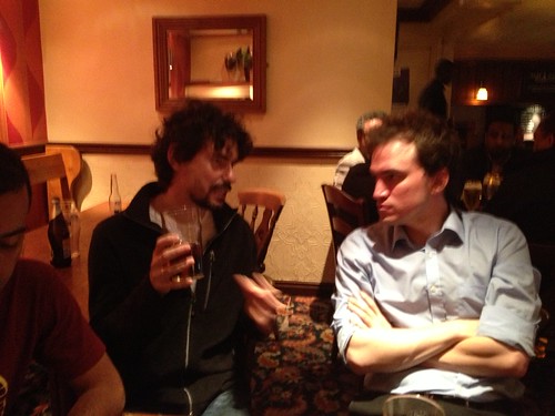
There were the pre-SOTM drinks with the MapBox guys. Strongroom bar was less annoyingly crowded than I remembered it, so that was good. I shall have to go back there (pretty close to my office) Having said that, we did have quite a crowd made up of OSMers getting together before the conference, and some other Shoreditch start-up tech community type folks.

flickr

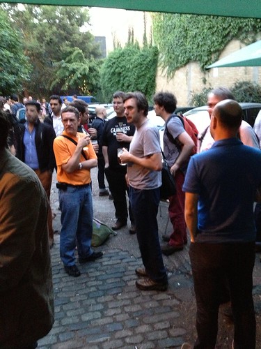
There was a couple of guys who had printed OSM maps onto little cards as a conceptual experiment in sharing city information with friends. Interesting idea I thought. Can’t find it online though. Mysterious. At this meet-up I full of the usual pre-SOTM excitement, plus I was excited at having just taken delivery of loads polo shirts.

See full entry

We’re out mapping again TONIGHT! Join us for the next London summer event in Victoria area. It’s also quite close to Westminster area. We’re starting outside Westminster cathedral in fact. So we should get some people from government involved, or some cops from scotland yard perhaps.

The last thing we did was the OpenStreetMap aniversary party. Sadly I missed it, but it looks like fun was had, and maybe Grant’s email campaign attracted some new faces?

photo on the wiki

See full entry

Location: East Marylebone, Mayfair, City of Westminster, Greater London, England, W1T 3PP, United Kingdom

London OSM birthday party tomorrow

Posted by Harry Wood on 9 August 2013 in English.

The OpenStreetMap Anniversary party is happening TOMORROW! In London it’s happening at the Dogget’s coat and Badge on the South Bank from 12:30. That’s the same venue as last year. Remember last year?

flickr

It’s quite nice in the back garden if the sun comes out. My recollection of that evening is a little hazy. I don’t think I wrote a diary entry about it, because I couldn’t remember what happened :-) …It was a good party.

I’m sorry I’ve neglected to promote this. The anniversary party is supposed to be the BIG one. …but sadly I can’t make it myself :-( I have wedding organisation commitments this weekend, and I know I’m not the only one. Gah! This is what happens. Next we’ll all be having babies, and then how will we get to the pub?

See full entry

Location: Bankside, Southwark, London Borough of Southwark, Greater London, England, SE1 9TG, United Kingdom

The Queen's Head + Mapping tonight!

Posted by Harry Wood on 31 July 2013 in English. Last updated on 15 August 2013.

The last London meet-up was the Queens Head pub which is here near Kings Cross. It was quite a long time ago now.

From what I remember of the Queen’s Head pub, it was a good meet-up. Nobody from the OKFN “open data meet-up” came to say hello to us, which was my reason picking this pub. Useless! We also didn’t manage to get a table, so sat in a strange circle instead. But on the plus side, there was a map on the wall! A beer map of America. Later we went for burritos in Kings Cross station.

Between now and then, we’ve had a heatwave here in London. I should probably have organised some lovely mapping evenings in the sunshine, but a heatwave causes various things to go wrong for me. The main thing is I don’t feel like drinking tea because it’s too hot, so I’ve spent the past few weeks feeling caffeine deficient. It aint pretty. Also it turns out my home internet cuts out when it’s too hot. Mega heat fail!

To add to the fails, I’ve also managed to lose the photos from the last meet-up. You’ll have to see a photo from last time we were in Kings Cross having burritos and imagine different people sat there :-) I’m getting used to using an iPhone as my main camera, but on this occasion I clicked delete then import, instead of import then delete. How very incompetent. I’ll tell you what. Here’s a stunning picture I took this morning instead (https://wiki.openstreetmap.org/wiki/Tag:shop=variety_store) :

See full entry

Location: King's Cross, London Borough of Camden, Greater London, England, WC1H 8AL, United Kingdom

Camden Mapping Party

Posted by Harry Wood on 2 July 2013 in English. Last updated on 9 October 2013.

A couple of weeks ago we had a London mapping evening around Camden. Derick was off mapping a different slice of cake and Andrew and I were mapping with a new person, and having a good chat about OpenStreetMap as we went.

Camden’s an area I know pretty well, and it’s quite well mapped already I thought, but maybe in need a refresh, and it’s starting to be on the border of London’s building outline overage, so we can start to take it that next level of detail. Down the backstreets there’s always new surprises to uncover too. I haven’t added the data yet but one of the buildings we encountered was made out of a bus.

In the pub we had an unusual gathering. Mainly unusual because there was no TomH and no Firefishy. But we did have Shaun journeying in from Ipswich to join us, and we had two new faces. One who had joined in with mapping, and one who we had met at #geomob previously.

flickr

See full entry

Location: Primrose Hill, Chalk Farm, Camden Town, London Borough of Camden, Greater London, England, NW1 8XN, United Kingdom

Pubs pubs pubs + Mapping tonight!

Posted by Harry Wood on 13 June 2013 in English.

So who’s coming mapping TONIGHT?? London mapping party in Camden

We’ve had a few pub meet-ups lately which I didn’t write anything about in my diary. This is kind of deliberate. As we move to a mapping evening <-> pub meet-up alternating timetable, I was hoping to talk more about mapping and less about pubs. I was also hoping to spend a bit less time writing diary entries. It is actually quite time consuming dear reader. KathleenD said in her SOTM.US presentation about organising OSM meet-ups that you should be willing to chill out and take a break if it’s no longer fun any more.

But no! Meet-ups must be documented! …well OK I’m going to document some recent London pub shenanigans very briefly. The truth is, the longer we stay in a pub, the more interesting OpenStreetMappy discussions we get into

Way back in the beginning of May we had a good pub meet-up in the Penderel’s Oak. I took some notes at this meet-up but I didn’t actually take any photos, but there was this one. Tee hee. I’m disappointed SplashMaps haven’t used this in their publicity. So we talked about SplashMaps a bit. We also discussed…

See full entry

The Marble Arch Mapping Party

Posted by Harry Wood on 29 May 2013 in English.

I’ve made a video. Check it out …but be warned. It’s kind of dull, until 6 minutes 22 second in, when the mapping goes TURBO!

video play frame

The sped up mapping effect is quite fun. I might have to try that again some time. But the idea of the video was to show how (or at least give a rough idea of how) we go about adding in the data, because we did the usual mapping party thing with beginners, of only demonstrating collection of data. …I’m talking about at the Marble Arch Mapping Party two weeks ago.

See full entry

Location: Marylebone, London, Greater London, England, NW1 5LG, United Kingdom

Tomorrow evening we’re going mapping around Marble Arch!

This will be a very beginner-friendly introduction to mapping. So if you’re in London come along, and tell all your friends. Anyone who’s never tried OpenStreetMapping, or curious about other ways of doing it. All you people lurking following https://www.openstreetmap.org/user/OSMLondon … Come tomorrow evening!

OSMLondon events have always been wide-open for beginners to come along to, but I’m stressing this aspect in the tomorrows event. This is part of an exciting new event formula in which we alternate “pub meet-ups” and “mapping parties”.

Last month we met at the Iron Duke pub with the intention of kicking off the mapping season. This is a good spot for some of the mapping priorities of central London, and I’m pleased that Derick managed to fill in some awesome details around St James Street. For my part I had signed up for a slice of cake to the South, but I spent so long in the office preparing a print-out of building outlines to check… that it go too late so I just went the pub (ohhh! That’s cheating!) It was the daylight confusing me.

Outside the pub (in the new evening daylight) the hot topic of conversation was…

An academic paper all about London OpenStreetMap mapping parties! (PDF)

Amazing and slightly weird that these people have analysed this in such detail. It feels a bit like somebody wrote a ten page academic paper about my personal bad habits. It’s weird that they do all of this without ever attending a mapping party themselves, but we figured it was a scientific analysis in which the scientist decides to avoid interfering with their subjects!

See full entry

Location: East Marylebone, Mayfair, City of Westminster, Greater London, England, W1T 3PP, United Kingdom

Boom! summer has arrived!

Well spring time at least. And most importantly, daylight hours after work. This means it’s mapping time again. We’ll be heading out mapping TONIGHT in the Mayfair area

I’m falling behind with… well everything in my life right now, because I’ve had holiday sandwiched between lots of work. But I’ve cranked out a mapcraft cake diagram. I’ve also laid down an invite for any new folks to get in touch with me if they’d like a demonstration of the kind of mapping data I tend to collect while roaming the streets of London. We’ll be doing this mapping from around 6pm until 7pm when we’ll be meeting at the pub. From them onwards it will be… a good old casual social meet-up!

We haven’t had one in a while, and yet I didn’t get around to writing up my notes on things we chatted about at two previous pub meet-ups back in March:

Crosse Keyes pub near Bank 7th March

[![flickr](http://farm9.staticflickr.com/8365/8548664354_fefe6e5f40_t.jpg)](http://flickr.com/photos/harrywood/8548664354/) [![flickr](http://farm9.staticflickr.com/8241/8548664254_c08a02f840_t.jpg)](http://flickr.com/photos/harrywood/8548664254/) [![flickr](http://farm9.staticflickr.com/8234/8547564537_7830da879b_t.jpg)](http://flickr.com/photos/harrywood/8547564537/) [![flickr](http://farm9.staticflickr.com/8105/8548664064_4c95e1b601_t.jpg)](http://flickr.com/photos/harrywood/8548664064/) [![flickr](http://farm9.staticflickr.com/8111/8548663958_017d7a226c_t.jpg)](http://flickr.com/photos/harrywood/8548663958/)

See full entry

Location: Monument, City of London, Greater London, England, EC3R 8BT, United Kingdom

The next London pub meet-up is tonight! Join us at the Crosse Keys pub from 7pm. As usual we’d love to have some new folks come along.

We had a french lady called Victoire joined us last time at the Blue Posts. She was interested in getting started with OSM and learning more about how humanitarian organisations can work with it. So we were talking through all of that.

flickr

See full entry

Location: East Marylebone, Mayfair, City of Westminster, Greater London, England, W1T 3PP, United Kingdom

Tidying my map embedding examples

Posted by Harry Wood on 19 February 2013 in English. Last updated on 20 February 2013.

First of all… It’s the London OpenStreetMap pub meet-up TONIGHT. Come join us!

I’ve been working a bit more on the map embedding examples I have on my website. For a long time that URL would take you to an apache directory listing of a bunch of files, including various junk experiments. But I kept linking people to it in discussions, and it was getting a bit embarrassing. Time to tidy it up a bit.

At the hack weekend I set-up a php script which allowed me to leave these files (mostly HTML files) arranged in directories, but launch a view of them which presented the examples with nice editor/preview panels (This is done with a neat javascript tool called codemirror)

screenshot

See full entry

Hack Weekend at the ODI

Posted by Harry Wood on 5 February 2013 in English. Last updated on 13 February 2013.

We just had the London OpenStreetMap Hack weekend, and I think I’m right in saying this was the biggest OpenStreetMap hack weekend ever!

by Alex, on flickr

Big thanks to the Open Data Institute, who provided the venue, and also sponsored the event. The ODI are funded by the technology strategy board to promote and support open data initiatives, and there are surely non more deserving than our London-born global not-for-profit project. However the ODI are particularly keen on supporting innovation which drives UK economic growth. I’ll be writing on the ODI blog soon, about ways in which OpenStreetMap does this (UPDATE: blog post on the ODI site now)

The ODI is also… my office. I work every day at a desk there doing placr.co.uk open transport data stuff. It was quite exciting holding an OpenStreetMap hack weekend at my place of work, but it did mean I had to get up early to be the first one there.

See full entry

Location: De Beauvoir Town, Dalston, London Borough of Hackney, Greater London, England, N1 4DA, United Kingdom

Lunch Today! + Monkey puzzle

Posted by Harry Wood on 19 January 2013 in English. Last updated on 20 January 2013.

Two big events coming up in London:

TODAY (Saturday) we’re having a big lunchtime pub meet up. hbogner is visiting with a whole team of Croatian OpenStreetMappers. Nine of them I think! They’ve been doing some kind of OSM workshop in rural Wales, the bit which just got the heaviest snow, but I’m sure that wont stop them getting back to London this morning, and we can meet with them to drink beer in the traditional english environment of Ye Olde Cheshire Cheese pub.

I’m sorry I’ve arranged this at rather short notice. I was umming and aahing because it clashes with something else I have this evening. This is the only reason it’s a lunchtime event actually, so if people want to carry on the merriment into the evening, or arrange a follow-on session at a different pub, I’m sure the Croatian folks won’t complain! I will be aiming to get there before 1pm though. Should be fun. For a while there I wasn’t sure if the Croatians had managed to find out about the event I’d set up. But it’s OK. They’re good to go. But I seem to be the only Londoner signed up on lanyrd so far! Looking forward to it anyway.

The other big event is the next London OpenStreetMap Hack Weekend. Feb 2nd 3rd. This looks set to be an international gathering too, with Emacsen flying in from the States, Ben from Belgium, and Katie from Germany. Again we need more Londoners signing up, but I know you all don’t like to commit until the last minute. The Open Data Institute are hosting and sponsoring! This will be a great venue for this I’m sure. It has “Open Data” in its name, and it’s a nice space. Check it out (we can get set up in the ‘boardroom’ there). Please consider coming along even if you’re a little bit scared by the word “hacking”. It’ll be fun I promise!

So those are some upcoming events.

See full entry

Tonight we’re going to the pub! It’s been a while. We need an OSMLondon celebration of Christmas, New Year, and one million users! So join us at the Monkey Puzzle in Paddington from 7pm

We had an awesome hack weekend in December, but last time we had a regular pub session was way back in November. We went to the Parcel Yard pub in the new bit of Kings Cross station.

In the pub we talked about …random topics which I wrote down at the time. Does anyone remember what we said about “floods in the tube”, and “airoplane radars”? And at the end of the list I have written down “weight loss solutions”. I don’t remember that converation at all. Maybe we came up with some brilliant medical breakthrough, but I’m afraid I didn’t write down any more detail. The cure for obesity is lost forever.

flickr

We talked about OpenMeatMap.org, a map locating fine meat produce from butchers, farmers markets, and other meat outlets. …which sadly doesn’t exist. But it should!

See full entry

Location: Paddington, London, Greater London, England, W2 6QS, United Kingdom

Hack Weekend at 10gen

Posted by Harry Wood on 6 December 2012 in English. Last updated on 10 July 2014.

As usual the run up to Christmas seems to be building up to a crescendo of chaos for me. But that’s the way we like it. Some of the Hack Weekend promotion was a little hurried/non-existant, but even so we did alright.

We had a lovely venue courtesy of 10gen the MongoDB company where Derick works. Our venue requirements are pretty simple, but this funky warehouse office in Shoreditch surpassed them. Thanks to 10gen for that, and to Derick for helping me run the event.

And we had pizza!

See full entry

Location: De Beauvoir Town, Dalston, London Borough of Hackney, Greater London, England, N1 4DA, United Kingdom

Blue Posts and lots of upcoming events

Posted by Harry Wood on 14 November 2012 in English.

We’ve got quite a range of London events upcoming in various stages of planning:

TONIGHT! - Join us in The Parcel Yard pub here in the new bit of Kings Cross station from 7pm for our regular London winter pub meet-up

Thu 22nd - geomob - They’ve just announced the line-up. Six different geo-presentations followed by pub. This is always a fun geo crowd, and usually a fair few OpenStreetMappers in attendance.

Sat 24th / Sun 25th - London branch of Operation Cowboy - This one is being organised by Tom Morris. He’s yet to confirm the venue, but has a plan. I hope this can be a good “training” event, at which people can go and learn or share tips about OpenStreetMap editing (That should be the focus I think. Not so sure about the “cowboy” ideas) But it’s not my event! Somebody else is organising something. Hurray! For that reason alone, I’d encourage everyone to support it. It will need experienced mappers and of course lots of inexperienced mappers to sign up to it. Tom has been promoting it to the wikipedians, but there’s probably quite a few other people who have been waiting for a non-pub related non-hacking mapping related OpenStreetMap event. How to get the word out to those people? I’ve pondered training kind of event formats for a long time. Hope it works well.

Sat 1st & Sun 2nd December - Hack Weekend. The dates are not necessarily set yet, but this seems like the most likely weekend. It means it’ll clash with Sanitation Hackathon (a humanitarian tech event), but it’s the best weekend for OpenStreetMap hacker availability. If you’re within range of London and interested in the technical side of OpenStreetMap (“internal” development or just using OSM data) then keep this weekend free. More details to come very soon hopefully.

And finally the Christmas Party 2012. We’ve got a wiki page so far at least. We should probably pick a date.

Phew! So thats the upcoming stuff.

See full entry

Location: East Marylebone, Mayfair, City of Westminster, Greater London, England, W1T 3PP, United Kingdom

The first London winter pub meet-up is TONIGHT. We’ve rolled over into “winter pub meet-up” mode, since the clocks have changed and the evenings are properly dim and dismal now. So join us tonight for… no mapping just beers!

Three weeks ago we had a “Summer” mapping evening. I got off a crowded tube train at Old Street and found I’d lost my android phone. Either dropped or pick-pocketed. So as I went outside and tried to gather some map data in the gathering winter darkness and pouring rain, around the stark tower blocks streets of St Luke’s area, I gently sobbed to myself (*)

Imagine how my spirits were lifted as I arrived at the Wenlock Arms pub, to be greeted by a table full of OpenStreetMap friends, a wonderfully cosy atmosphere, a fine array of real ales, and a phone call to say “I’ve found your phone on the tube. D’you want to collect it tomorrow night?”

More OpenStreetMap friends arrived. We only had one little table but maybe 10-15 people! The Wenlock Arms is a small pub, but we were able to spread onto quite a few seats, plus a lot standing at bars etc, but still feeling like a nice cosy OpenStreetMap gathering. We also didn’t really fit into one photo. This was our best attempt:

See full entry

Location: De Beauvoir Town, Dalston, London Borough of Hackney, Greater London, England, N1 4DA, United Kingdom

The Monkey Puzzle pub switch2osm!

Posted by Harry Wood on 3 October 2012 in English. Last updated on 6 October 2021.

I was so hyper-enthused with a glowing sense of geotastic-all-conquering pride after last week’s London pub meet-up, that I went ahead and set up the next pub meet-up. Yes. We’ve had the details on the wiki page two weeks in advance. How very well organised! Do come along and join us on Thursday 11th in a pub over in Hoxton.

But what was I so pleased about at last week’s meet-up?

The Monkey Puzzle did a switch2osm! It was a sort of live-action-laptop-over-the-bar switch2osm.

I’ve chatted to the landlord, Gary, a few times before. He knows about those crazy guys who come to merrily drink with an “OpenStreetMap” sign on the table. And when I said they should switch from google maps to OpenStreetMap on the Monkey Puzzle website, he said “Errr. Yes… yes we should”, and after some confused behind-the-bar discussions about who knew how to update the website and what that would involve, he went and fetched his laptop.

This was highly amusing to me at the time, but then I had had several pints. Presented with a very slowly loading wordpress admin interface I didn’t try to do anything too fancy, but swapped out their google maps iframe and put in an OpenStreetMap one. Boom! switch2osm live and direct!

See full entry

Location: Paddington, London, Greater London, England, W2 6QS, United Kingdom

iOS, geomob and pub tonight

Posted by Harry Wood on 25 September 2012 in English. Last updated on 28 September 2012.

As I get psyched up ready for a London mapping session this evening (Listening to “Eye of the tiger”. That sort of thing) I realise it’s been an interesting few weeks…

Last week I went to Amsterdam and presented OpenStreetMap and H.O.T. at the PICNIC festival. Here’s a video of the session. There’s another interview video still to come I think. I’ll blog some photos and more details about that. UPDATE: blog now here

Last Thursday I had been sprinkling a few comments around the web, on press coverage of Apples debut of their iOS6 maps. iPhone users the world over, were loudly complaining about apple’s switch from google maps. This really shows how strong the big G’s dominance of web & mobile mapping is. Phone users and also tech-savvy app developers are insistant upon google maps. It’s hardwired deep into their psychology now, such that forcibly presenting a different map causes great upset. This is what OpenStreetMap is up against, but last week apple swung a battering ram at google’s mappy castle. They may be annoyed but users and developers being liberated. They’re experiencing a realisation that there is a choice of map providers. It’s only a short leap of logic from there to go seek the open alternative. That’s us! Over here!

So after spending the whole day pointing out what an evil grip google holds on people’s map preferences (slagging off google essentially) on various forums, I half expected to be refused entry the google campus building for Thursdays #geomob. Maybe I thwarted them by turning up late. I caught the end of Lawrence’s talk showing various old maps, and concepts for maps, particularly looking at “linear maps”. Anyone done any more OSM experiments on Linear Maps to list on this wiki page?

See full entry