OpenStreetMap logo OpenStreetMap

Users' Diaries

Recent diary entries

Posted by AngocA on 2 October 2022 in Spanish (Español).

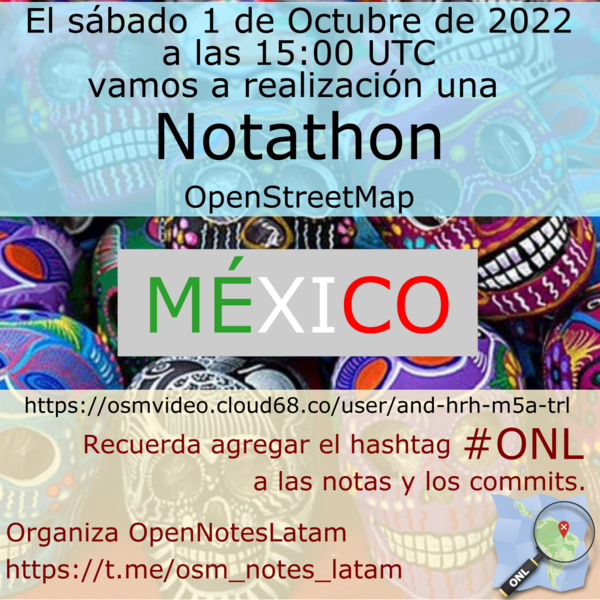
El sábado 1 de octubre de 2022, se realizó una notathon, como se acostumbra hacer una semana después de la junta Latam. En esta ocasión se hizo en México, y se coordinó por medio de BigBlueButton - OSMVideo, donde participaron varias personas.

Notathon México

En esta ocasión se uso DAMN-project para dividir las zonas. Para la división de áreas se filtró por solo las notas creadas a partir de la aplicación Maps.me. Esta es la tarea de DAMN: https://client.damn-project.org/?area=2407

Se enseñó cómo usar el plugin de JOSM, el cual baja automáticamente las notas, y esto permite trabajar en varias áreas, sin tener que salir del editor.

En total se resolvieron 63 notas, con participantes principalmente de México (alex_mayorga, Mapeadora, Sandra, entre otros), pero también hubo asistentes de Venezuela (risturiz), Argentina (Manuel Retamozo) y Colombia (AngocA).

See full entry

Location: Centro, Ciudad de México, Cuauhtémoc, Ciudad de México, 06000, México

After you’ve been out dancing 💃 & drinking 🍸 at the club🪩, that take away joint open at 2am 🌆 suddenly looks very appealing 🍔🍟🍕. So for every night club in OSM, I calculated the distance to the nearest fast food take away. Here’s a map of where you have to go >20km for a take away:

map of the world

🗺️ explore this as a web map here

See full entry

Motivations

Have you ever wondered when on earth, you would have opportunity to meet in person, have a handshake, a hug, an off-screen smile, take a coffee or even a lunch together with friends and colleagues you have remotely worked with, as weeks, months and years keeps counting in a virtual world of OpenStreetMap global community? Yes, our trending techs and AI keeps offering us the best of smart connectivity with everyone in a digital space of daily online activities that builds around us a world of virtual communities with uncertainties, barriers and boundaries of never meeting physically in our life time. Have you ever, thought about, the uncertainties of meeting in person such cool guy as Geoffery kateregga and the rest of HOT and OSM Africa local community leaders after consistently working virtually in HOT working groups, OSM Africa Mapathon, Community meeting and the rest for weeks, months and years in a virtual world of OSM.

What about meeting your boss-Pete Masters the Head HOT Global community (of course, if you are a community leader or aspiring and being mentored to be one) after having series of community mentorship, supervision, and virtual meetings through WhatsApp zoom, jitsi and the rest of the virtual platform that makes you forget the distance barrier and that you never had an opportunity to meet in person. Infact, after meeting virtually for years gone by, it only dawned on me that my very boss-Pete Masters had such an intimidating height that would dare me stretching out my neck when I first met him on my arrival for SOTM2022, in Florence, Italy. So, my virtual assumptions were wrong after all, thanks to FOSS4G2022 and unSummit HOT.

See full entry

Location: Alakahia, Obio/Akpor, Rivers State, 500004, Nigeria

Столкнулся с такой проблемой при редактировании дорожек во дворах жилых кварталов. Если из каталога объектов выбрать просто “пешеходная дорожка”, то после сохранения изменений на карте эта дорожка обозначается как “тротуар” (хотя тротуар как я понимаю это разновидность дорожки как правило прилегающая к проезжей части и с твердым покрытием). Внутри дворов никаких проезжих частей нет и соответственно тротуаров тоже быть не может. Я нашел временный выход, выбирая из каталога значение “тропа”. Но тропа в моем понимании - это специфическая лесная/парковая дорожка, а не внутриквартальная. Буду благодарен за помощь в этой теме

Location: Усть-Муллы, Дзержинский район, Пермь, Пермский городской округ, Пермский край, Приволжский федеральный округ, 614058, Россия

หลวงพี่รูปหนึ่งนั่งสมาธิอยู่ริมน้ำ ได้ยินเสียงดิ้นรนในน้ำก็ลืมตาขึ้น เห็นแมงป่องตกอยู่ในน้ำ. ท่านก็ใช้มือช้อนมันขึ้นมา ขณะเดียวกันแมงป่องก็ชูหางขึ้นแล้วต่อยไปที่มือท่าน ท่านปล่อยแมงป่องลงที่ฝั่ง แล้วหลับตาทำสมาธิต่อ.

ผ่านไปสักครู่ก็ได้ยินเสียงดิ้นรนในน้ำอีก ท่านลืมตาขึ้น เห็นแมงป่องตกลงไปในน้ำอีก ก็เอามือช้อนมันขึ้นมาอีก แน่นอนแมงป่องก็ต่อยไปที่มือท่านอีก ท่านก็หลับตาทำสมาธิต่อ

ผ่านไปสักครู่ เหตุการณ์ก็ได้เกิดขึ้นซ้ำอีก

หลวงตาที่อยู่ข้างๆก็พูดขึ้น “ท่านไม่รู้หรือว่าแมงป่องมันต่อยคน?”

หลวงพี่ตอบว่า “รู้ โดนมันต่อยสามครั้งแล้ว”

หลวงตาพูดว่า “แล้วท่านทำไมยังจะช่วยมันอีก”

หลวงพี่ตอบว่า “การต่อยคนเป็นสัญชาตญาณของมัน. แต่ความเมตตาเป็นสัญชาตญาณของเรา. สัญชาตญาณของมันไม่สามารถมาเปลี่ยนสัญชาตญาณของเรา”

ขณะนั้นเองก็ได้ยินเสียงดิ้นรนในน้ำอีก แมงป่องตัวเดิมนั่นแหละ

หลวงพี่ไม่รีรอ เตรียมที่จะนำมือที่บวมเป่ง ยื่นไปช่วยมัน

ขณะเดียวกัน หลวงตาก็ยื่นกิ่งไม้ให้กับหลวงพี่. ท่านก็นำกิ่งไม้ช้อนแมงป่องขึ้นมา

หลวงตายิ้มและพูดว่า

“ความเมตตานั้นดี ในเมื่อมีความเมตตาต่อแมงป่องก็ต้องมีความเมตตาต่อตัวเองด้วย ฉะนั้นความเมตตาต้องมีวิธีการของความเมตตา ต้องดูแลตัวเองให้ดี ถึงจะมีสิทธิไปช่วยผู้อื่น”

เรื่องนี้ทำให้ได้คิดถึงประโยคหนึ่งที่ผู้คนชอบพูดกันในปัจจุบันนี้ว่า “เดี๋ยวนี้จะทำตัวเป็นคนดีนั้นยาก”

ใช่แล้ว สัญชาตญาณของคนดีคือทำความดี. แต่ผู้ถูกช่วยอาจจะไม่ใช่คนดี และผลของการช่วยคนก็อาจจะไม่เกิดผลที่ดี. แล้วทำไมจึงเป็นเช่นนี้?

เหมือนกับที่หลวงตาพูดไว้ “เมตตาต้องมีวิธีการของความเมตตา”. “ความเมตตานั้นดี ในเมื่อจะเมตตาต่อแมงป่องก็ต้องเมตตาต่อตัวเองด้วย”

ความเป็นจริงเตือนเราว่า ต้องรู้จักรับผิดชอบต่อตัวเองก่อน ถึงจะสามารถรับผิดชอบต่อผู้อื่นได้อย่างแท้จริง. คนที่ไม่สามารถรับผิดชอบต่อตัวเอง แล้วจะไปรับผิดชอบต่อผู้อื่น จะเป็นไปได้ไหม? ต้องดูแลตัวเองให้ดีก่อน ถึงจะมีสิทธิ์ไปดูแลผู้อื่น

และประโยคนี้ก็ชอบมาก “สัญชาตญาณของแมงป่องนั้นต่อยคน แต่สัญชาตญาณของเราคือความเมตตา สัญชาตญาณของมันจะไม่สามรถมาเปลี่ยนสัญชาตญาณของเรา”

“ความเมตตานั้นดี ในเมื่อจะเมตตาต่อแมงป่องก็ต้องเมตตาต่อตัวเองด้วย และต้องมีวิธีการของความเมตตาด้วย”

See full entry

Location: เทศบาลเมืองสระบุรี, ตะกุด, อำเภอเมืองสระบุรี, จังหวัดสระบุรี, ประเทศไทย
Posted by rhtb0 on 28 September 2022 in Korean (한국어). Last updated on 5 August 2025.

단순히 아파트 동호수를 101, 102, 103 등의 숫자로만 표시 하는 것은 문제가 있다고 봅니다. 검색창에 102만 처도 해외의 우편 번호가 먼저 나옵니다. 101은 부산의 역으로 나옵니다. 실생활에서도 A아파트 102동이라고 하지 숫자로 부르지는 않습니다. 검색엔진을 고려해서 숫자만 붙이지 말고 101동, 102동, 103동, 201동처럼 동을 붙여서 적어야 찾기 편해집니다. 101 102 201등 숫자는 어느 아파트의 동을 검색하려면 찾기가 어렵습니다. 네이버 지도나 카카오맵에서도 멀리서는 숫자로만 표기하지만 동은 가까이 축적해야 붙습니다.

RapiD is an alternative to the OpenStreetMap iD editor that adds the ability to easily add data from approved external sources to OSM. Chances are that you—like me—know RapiD from the MapWithAI initiative, Facebook / Meta’s effort to publish road geometry derived from aerial imagery using machine learning. RapiD started out to support this effort; a fork of the iD OSM editor, RapiD added a layer to display the ML-detected road segments, and a nice user interface to add these segments to OSM, connecting them with the existing road network where possible.

rapid in ml roads mode

See full entry

Location: Central City, Salt Lake City, Salt Lake County, Utah, 84111, United States
Posted by Serg_Sel on 27 September 2022 in Russian (Русский).

Оох ну и много же дел в моём Барнауле… Столько всего есть уже на картах, но много чего нет… Ну, я начинаю потихоньку дополнять карты хотя-бы в своем районе.

Location: Индустриальный район, городской округ Барнаул, Алтайский край, Сибирский федеральный округ, Россия
Posted by Lars Schwarz (Oldenburg) on 26 September 2022 in German (Deutsch). Last updated on 27 September 2022.

In Deutschland sind ca. 2.400 Fahrradstraßen in OpenStreetMap erfasst.

Mehr als die Hälfte der erfassten Straßen leider ohne entsprechende Verkehrszeichen.

Da die reine Quantität von Fahrradstraßen nichts über die Qualität aussagt, habe ich im Rahmen der OSM-Verkehrswende-Berlin Gruppe angefangen den aktuellen OSM-Erfassungsstatus etwas genauer zu analysieren.

Viele der erfassten Fahrradstraßen sind nur rudimentär getaggt, wichtige Zusatzzeichen (KFZ frei, Anlieger frei etc.), die Rückschlüsse auf die Qualität (Stichwort „echte“ und „unechte“ Fahrradstraße) zu lassen, fehlen leider häufig.

Neben dieser Mindestanforderung sollte auch die Zugehörigkeit zu einem vorhandenen Radnetz (LCN, RCN) sowie die Breite und auch eine eventuelle Relation zu einer Fahrradzone mit erfasst werden.

Ich werde diese Diary-Eintrag die nächsten Tage um alle relevanten Tagging-Informationen erweitern und auch Links zu eine einfachen Projekt Seite erfassen.

Eine statische Liste aller Fahrradstraßen mit mindestens einem zugewiesenen traffic_sign findet ihr hier: https://wiki.radmonitor.de/

Fersenlutzel und Pudelmutter am Südostrand der Alpen ist eine sehr spannende Sagenlandschaft, unbedingt Wert georeferenziert zu werden, aber in JOSM muss ich es nicht haben. In JOSM landen primär die georeferenzierten Papierkarten mit Rad- oder Wanderwegen, die ich zur Qualitätssicherung meiner Daten verwende.

Nativ unterstützt JOSM keine georeferenzierten Einzelbilder, dazu sind Plugins erforderlich.

Mit JOSM georeferenzieren

Für kleine Bereiche geht das recht gut mit dem Plugin PicLayer [1]. Die optische Vergleichsmethode eignet sich gut für Kartenausschnitte mit wenigen km². Für größere Bereiche wird es zunehmend schwierig. Da ist es besser externe Programme zu verwenden. Welche spielt keine so große Rolle, das Prinzip ist überall ähnlich.

Eine Ausnahme ist das QMapTool Gitterwerkzeug in QMS [2], das ein viel schnelleres Referenzieren von Karten mit Koordinatengittern erlaubt.

See full entry

I have been an active OSM mapper (and contributor to some HOT task mapping projects in different countries ) since 2013, mainly mapping based on satellite imagery. My main focus has been on Ethiopia, North Korea and DR Kongo.

At the moment (from March 2025 on) I try to map waterways and watersheds of the Ethiopian tributaries of the Blue Nile (called አባይ = ābayi/Abbay/Abbai in Amharic). A lot of theses waterways and the areas around them have been very poorly mapped yet. I have started with the river which is called Rahad (نهر الرهد) in Arabic and Shinfa (ሽንፋ ወንዝ) in Amharic.

The rivers in the Ethiopian highlands are of crucial importance for the cultivation of the land and the settlement structure - in a way which is unusual and often uknown for European people: The settlements are usually on top of the mountains (using the rain at the main water source) between the rivers, not at the rivers. A lot of the rivers and their ravines are blocking travelling and transport, not supporting it.

River Shinfa (ሽንፋ ወንዝ / نهر الرهد)

Relation of the main course of the river

Detailed Mapping Finished based on Esri Imagery
Downstream
River Shinfa - right tributary A
* about 10m wide at confluence, clear/dark water, meandering (SI = 1.84)
* so far mapped length 7.60 Km - E to W
* from 12°03’21.0’‘N 36°37’51.5’’ E to 12°03’54.6’‘N 36°35’39.0’’ E
* height: 1225 m to 1080 m (19.08 ‰ botton slope)

River Shinfa Section 1
* up to 30 m wide, ravines, light brown water, twisting (SI= 1.436)
* length 7.18 Km - SE to NW
* from 12°03’54.6’‘N 36°35’39.0’’ E to 12°05’33.5’‘N 36°33’28.1’’ E
* height: 1080m to 1000 m (11.14 ‰ botton slope)

River Shinfa - right tributary B
* 35m wide and more at confluence, light brown water, twisting (SI = 1.504)
* so far mapped length 21.39 Km - NE to SW
* from 12°08’39.8’‘N 36°40’37.9’’ E to 12°05’33.5’‘N 36°33’28.1’’ E
* height: 1200 m to 1000 m (9.35 ‰ botton slope)

See full entry

Location: North Gondar, Amhara Region, 6200, Ethiopia