Users' Diaries
Recent diary entries
Project: Uganda 2022 Ebola Outbreak - Kitumbi Subcounty Kassanda District Project
Today I got the email notification that the last of my tasks had been verified, and at 9:00am received confirmation that the project has been completed.
Total Hours Contributed: 4 hours 10 min
Checking the task manager there are 2 more projects relating to the Ugandan Ebola Outbreak. As I have gotten used to the style of mapping I have decided to start on another of their district mapping projects:
UGANDA 2022 EBOLA OUTBREAK - BANDA SUBCOUNTY MITYANA DISTRICT

I recently wrote about using a Tag-Fix MapRoulette Challenge to update OSM data in an efficient way, no editor required. Tag-Fix is one of two newer Challenge types MapRoulette has available. The other one is called Cooperative. They are called Cooperative because it’s a cooperation between you and the Challenge owner. The Challenge Owner provides the OSM changes, you validate them, tweak them as needed, and commit them to OSM. Cooperative challenges are ideal for when you may be thinking about an import, but you would like to have each feature manually verified by a mapper.
Today, we will look at how to set up a Cooperative Challenge using Microsoft Building Footprints open data. (In a future post we’ll look at how to work with the Challenge as a mapper.) This is not really a beginner’s tutorial; we will be working with PostGIS, QGIS and the command line tools imposm and ogr2ogr. If you have those tools installed and are just a little familiar with them, you should be able to follow along fine!
This is what the final result will look like:
Posted by bkil on 29 November 2022 in Hungarian (Magyar).
Last updated on 2 December 2022.
Részletek / details: https://wiki.osm.org/Hungary/20230121
Tortával jutalmazzuk a szabad platformunkon jelentkező első 20 tagot: OSM wiki, OsmCal, GetTogether, Mobilizon, Friendica-Mastodon, levlista.
Cake will be awarded to the first 20 members who RSVP on one of our open platforms: OSM wiki, OsmCal, GetTogether, Mobilizon, Friendica-Mastodon, mailing list.

Posted by _PG_ on 29 November 2022 in Russian (Русский).
Last updated on 8 February 2023.
Напомню суть проблемы. 11 ноября Максар заблокировал на своих серверах доступ с российских IP-адресов. Вместо тайлов он возвращает HTML с ошибкой “403 Forbidden”. Это ограничение очень легко обойти, если подключаться через Tor, через прокси-сервер или через VPN. Проблема в том, что при этом весь трафик идет через VPN/Прокси/Tor, а значит будет работать медленнее. А нам не надо заворачивать в Tor всё, нужно только запросы к серверам Максара.
И вот, у меня получилось. Я настроил проброс JOSM-запросов к слою Maxar Premium через Tor Browser. Все прочие запросы идут напрямую.
Описание схемы тезисно:
-
Ставим Tor Browser. Он интегрирован с клиентским ПО Tor, оно запускается и закрывается синхронно с браузером и работает как локальный socks5-прокси, к которому может подключаться абсолютно любое ПО на компьютере.
-
Ставим локальный http-прокси Privoxy. Указываем ему в конфиге “запросы к серверам Maxar заворачивать в прокси Tor, остальное качать напрямую”.
-
Настраиваем JOSM чтобы он работал с интернетом через http-прокси Privoxy
1) Установите Tor Browser. Для работы вам понадобится чтобы он был запущен и подключен к сети Tor. https://www.torproject.org/download/ Как вы будете его скачивать - без понятия, в России этот сайт заблокирован. Любой способ обхода блокировок в помощь. Простейший вариант - на время скачивания добавить в браузер плагин Browsec, но вообще мне этот плагин не нравится назойливостью рекламы, поэтому я отключаю его сразу после завершения использования. Если вы не пользовались Tor раньше, учтите, что в России он работает только через мосты (bridges), причём только через те, которые ещё не успел выявить и задавить РКН. После установки и запуска вам потребуется войти в настройки и запросить три случайных моста из списка тех, которые ещё работают:
Settings->Connection->Add New Bridge->Request a bridge from torproject.org
Posted by amapanda ᚛ᚐᚋᚐᚅᚇᚐ᚜ 🏳️⚧️ on 29 November 2022 in English.

Posted by joyceeemaeee on 29 November 2022 in English.
Last updated on 30 November 2022.

The SotMAxPnM2022 International Conference emphasized the value of employing open source, open data, and open mapping in the current state of technological growth. - November 21–25, 2022, Legazpi City, Albay, Philippines. Events were held by several groups in addition to the conference sessions and workshops. Also hosting their social event were Youthmappers, Mapbeks, and GeoladiesPH. My memories of the Pista ng Mapa Conference and the State of the Map Asia Conference are still fresh, but they will always be remembered.
Let me express my gratitude to the State of the Map Asia x Pista ng Mapa Organizing Team for the opportunity to be one of the local travel grantees. Also, attending the conference does not have enough money, but big thanks to Sir Aimon Pangan and to COLLADEV for adopting our YouthMappers chapter for the whole week (we miss the breakfast, Ka sama ka Sir). We do not have any funds, but I/we are forever grateful for this once-in-a-lifetime opportunity!
To the Bicol University College of Engineering, thank you very much for the kind welcome. We really enjoyed our time at your prestigious university. We appreciate that you keep our surroundings pristine and secure. A special thanks to Christine and the two guys who were with us that day for showing us around their big campus.
Fast-forward to the “State of the Map Asia x Pista ng Mapa” occasion. The work of Mr. John Louie Fabila in producing 3D animated maps to encourage greater interactions captivated me. Sir Aimon Pangan for sharing his work on Data-Driven Development for Policymaking with Kobocollect; I was blown away by how Sir Aimon works with the community in other places. Also, to the UP Tacloban Youthmappers, Kuya Michael Joshua Orais, although I didn’t attend the workshop because it was already full, I was fascinated by your presentation, “Ang Unang Paglipad,” because the first YouthMappers chapter has drone training.

현재 서산 근교 지역의 중앙분리대가 있는 왕복 4차로 이상 도로에 도로 지물을 변경할 예정입니다. 대개 과거 80~90 km/h의 제한속도가 설정된 지역에 1차 도로로 변경할 예정입니다. 추후, 전국 고속도로의 제한속도 및 차선, 방향(destination) 추가를 반영할 예정입니다.
Posted by JaphetMasunzu on 29 November 2022 in English.
Introduction
The OSM community is made up of volunteer contributors from different countries around the world, who are dedicated to improving the world map. To contribute to OSM it is required first to have an OSM account and to be trained on how to contribute. These contributions are subject to validation in order to censor errors that may have crept in during the mapping process. Through this data quality internship, we had the opportunity to be trained on how to do the validation process.
Frequently observed errors
During the validation practice, for the tasks that were validated so far, here are the common mistakes made by the contributors that we noticed: - Buildings with non-square corners. However, the instructions for the projects always give clear directions for this! - Not completely mapped spots, especially in rural areas where there are circular buildings; - The use of some inappropriate tags, especially for circular buildings like “building=hut”.
Recommendations
Here are some recommendations we make: - Always remind contributors to a mapping project right at the beginning, especially beginner mappers that before locking a task into a project for mapping, first read the project instructions carefully; - Validate the tasks in time, so that the given remarks help the cartographers to improve; because a remark given after 1 or 2 years in my opinion has lost its meaning. Thanks again HOT for this good opportunity where we are being trained and informed a lot.
ถนนศรีจันทร์ บ้านเลขที่99 หมู่ที่6 บ้านหนองไห เทศบาลตำบลโพนทอง อำเภอเชียงยืน จังหวัดมหาสารคาม 44160
Project: Uganda 2022 Ebola Outbreak - Kitumbi Subcounty Kassanda District Project
Starting today with reviewing my notifications within the HOT Tasking Manager.
The following tasks have now been verified by moderators and are completed for the project:
-
Task 306 (this was the one I had additional mapping to complete yesterday)
-
Task 428
-
Task 150
-
Task 266
-
Task 233
The project that I have been working on (Uganda 2022 Ebola Outbreak - Kitumbi Subcounty Kassanda District Project) is now nearing completion with only 3 sub-squares left to map (the remaining tasks are awaiting verification prior to completion)
- Task 512 - 35 mins
The last task I helped with Task 511 (25 mins) had a number of areas where I couldn’t distinguish between houses or ground distrubances, so instead I completed as much as I could then submitted the task as uncomplete to allow another mapper to review and contribute.
As the only other remaining tile was locked this is the end of this project for me and I will need to look for a new project to work on next.
Total Time: 1 hour
Posted by Jaqueline Amorim on 28 November 2022 in English.
Getting new users to contribute to collaborative mapping with OpenStreetMap sometimes can be a hard task, and even more difficult when you think about attracting new women users, especially if you are in a country like mine, Brazil.
Why do I speak of new women users? Because if you are in a country like mine, Brazil, most users are men, and this is not the reality in cartography courses, then why women in general aren’t participating, because they do not feel encouraged to participate, is that it?
In this text I will talk a little about my experience for you. Here in the group that I am part of with my college friends, we were having a hard time getting new girls to join the group and trying to understand this reality we met the group Geochicas OSM, a group of Latin America, a collective that came up with the idea of closing the gender gap among those who participate in the collaborative mapping project OpenStreetMap (OSM).
Posted by umbraosmbr on 28 November 2022 in English.
WORKSHOP MAPEAMENTO PARTICIPATIVO E CARTOGRAFIA SOCIAL - 7 e 14 DEZ 2022
Participatory Mapping and Social Cartography Workshop - 7th and 14th DEC 2022

Posted by trixabella on 27 November 2022 in English.
Last updated on 28 November 2022.
Project: Uganda 2022 Ebola Outbreak - Kitumbi Subcounty Kassanda District Project
First today I reviewed the feedback given on yesterday’s tasks.
The following tasks have been verified by a moderator and are now marked as completed for the project.
-
Task 69
-
Task 163
-
Task 359
Next I read the feedback left on Task 306. It looks like I missed some buildings off this task, which I have now re-reviewed and added in the missing locations, this took 15 minutes. It was nice to recieve feedback from the moderator regarding the updated version. This is helpful as I continue learning.
“Good work @[trixabella] Thank you for contributing your time to helping with this project. You are correctly identifying the buildings in the background imagery and drawing them at the correct size and shape. Your tracing of roads is also good. Please keep mapping.” RAytoun
I have also completed the following task which are now ready for validation:
-
Task 233 - 30 mins
-
Task 428 - 5 mins
-
Task 429 - 10 mins
Total Time: 1 hour

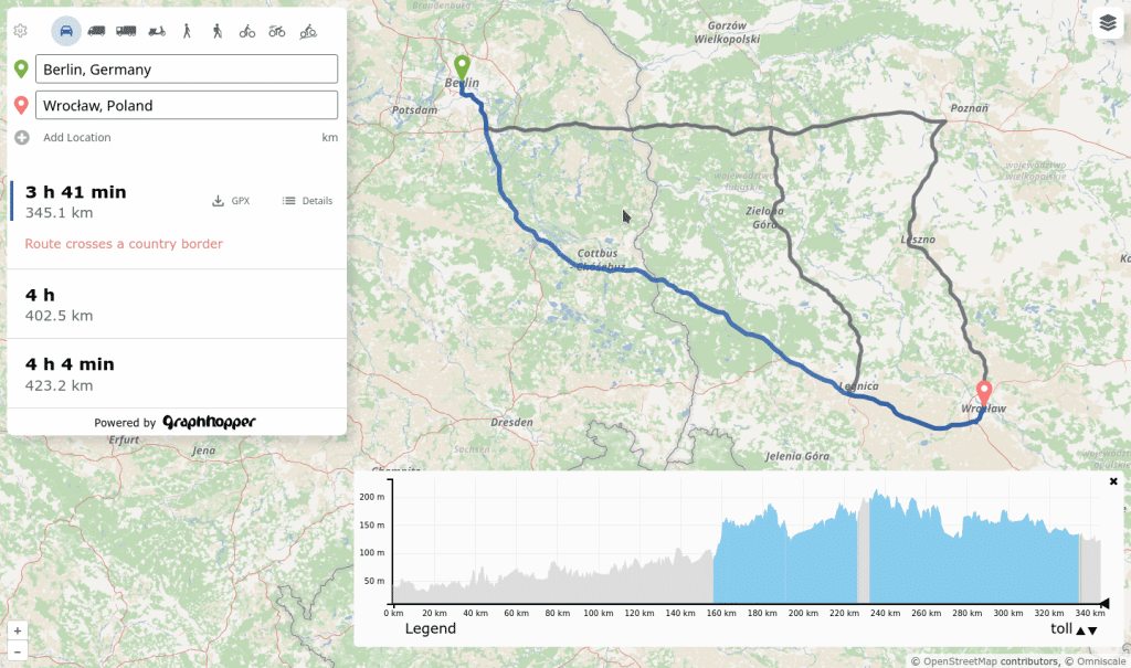
I’m proud to announce the release of a completely rewritten front end that supports alternative routes, includes the custom model feature, works on mobile devices and has many more features!
Read more and try it out.

This is the fourth in a series of posts which I’m doing this year inspired by another user’s monthly updates. In the two months since my last update, I visited Palos Verdes (a bit south of Los Angeles) and mapped a few other places remotely.
Also there is a geo-focused Mastodon server; you can find me there: @mapmeld@mapstodon.space
Palos Verdes / Los Angeles
There are a few fancy neighborhoods segmented by dirt paths which are either for utility access, bridle paths, or fire control. For example one road had horse stables on it, and another served as the boundary between two cities. There are a few access points which are barricaded with a reflector or guard rail, but you can still walk onto the path and onward into the next neighborhood. I talked to a resident who said that his car GPS considers these thru-ways, so it’s possible that they were more connected in the past? I would say OSM coverage of these was good but not great (particularly: linking entrances and exits to the road way, or missing shorter paths and alleys).
A local park was named “Los Arboles Rocketship Park” on Google. I visited and confirmed there is an actual sign with Rocketship in the name (based on a sculpture there).
Central Asia research
I’m considering a hiking trip to Tash Rabat, a Silk Road era landmark in Kyrgyzstan. OSM has the dirt road from the highway, and an additional trail north to Баетов which is missing from Google.
I was also looking at locations with Islamic architecture. Turkistan, Kazakhstan has parcel data (labeled building=yes) and then addresses added by Toyota. So that data is on a bit of a journey. A large area in the city center recently got redeveloped into a park, which I updated on the map. Google reviews dispute how often the park is fully open to the public, whether boats are working, etc.
Grand Canyon
After an announcement that the parks service was renaming Indian Garden to Havasupai Gardens, I renamed the area but kept the alt_name tag.
OSMBuildings
Posted by yvonnepaje on 27 November 2022 in English.
Last updated on 30 November 2022.
Location:
Em's Barrio East, Legazpi, Albay, Bicol Region, 4500, Philippines
Posted by Ayam Sableng Kedai ChaCha on 27 November 2022 in Indonesian (Bahasa Indonesia).

Ayam Sableng Kedai ChaCha
Jl. Pembangunan / Gg. Duku No 62a RT 01 RW 04 Jombang Ciputat Tangerang Selatan
Posted by trixabella on 26 November 2022 in English.
Last updated on 28 November 2022.
Project: Uganda 2022 Ebola Outbreak - Kitumbi Subcounty Kassanda District Project
Today I spent time working a new project, this aim of this is to map a region following an Ebola Outbreak to provide Health Authorities and MSF to better map the affected areas and ensure adequate provision of resources.
I worked on adding Buildings, Roads, Tracks, Paths & Waterways. Majority of task contained adequate satellite imagery to spot all these details, however I added comments during completion submission on one task where there were some white circular objects showing which could have been huts however the images weren’t conclusive so they weren’t mapped.
I completed the following tasks ready for validation:
-
Task 150 - 15 mins
-
Task 184 - 15 mins
-
Task 163 - 20 mins
-
Task 69 - 15 mins
-
Task 359 - 10 mins
-
Task 266 - 15 mins
-
Task 306 - 15 mins
-
Task 398 - 15 mins
I also contributed to the following tasks which require additional input before they are finished:
-
Task 84 - 5 mins
-
Task 362 - 5 mins
Total time: 2 hours 10 mins

- Foreword + Summary
- Details:– Early to 1199
- Details:– 1200 to 1399
- Details:– 1400 to 1599
- Details:– 1600 to 1799
- Details:– 1800 to 1899
26 November 2022
The last page in this sequence of diary entries used to be “1800 to current”. It became so large as to become unreasonable, so I have broken it up into two pages: the original first half is now 1800 to 1899, whilst the second (this page) is now “1900 to current”.